Peru Map
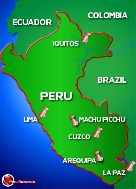
Peru is located to the north west coast of South America and boarders countries such as Brazil, Colombia, Ecuador and Bolivia.
Peru can be divided into three areas known as the highlands, this area is in-twinned with the andes mountains and runs directly through the centre of the country. Secondly the jungle regions are located around the amazon rainforest to the east of Peru and finally the coastal regions to the west of the country.
Peru has over 2414km of coast line on which the capital Lima lies. Lima is the largest sity in peru with a population of over eight million people. Arequipa is the second largest city in peru and is in the southern region of Peru and lies in view of volcano El Misti currently inactive with its last eruption in 1974.
The city of Cuzco was the capital of the ancient Inca civilization that is at an altitude of over eleven thousand feet. Situated 70km south of Cuzco is the famous lost city of the Incas which is a world renowned tourist site that is situated on the crest of mount Machu Picchu.

